UCGIS Elections, 2021
The Nominating Committee and the Board of Directors are honored to present these individuals to the UCGIS delegates for consideration in the 2021 elections. Online voting by delegates will begin on Thursday June 3, 2021, and will conclude on Wednesday June 9, 2021. Selected individuals will begin their positions on July 1, 2021.
President-Elect (one to be selected)
 David Bennett, University of Iowa David Bennett, University of Iowa
Bio: I am a Professor and department chair at The University of Iowa (UI) in the Department of Geographical and Sustainability Sciences. I am a returnee to UI. After receiving my Ph.D. from that institution in 1994, I accepted a position at Southern Illinois University Carbondale and then the University of Kansas. I returned to UI in 2000. I am a GIScientist. Throughout my career I focused my research on the representation of socioecological systems through, for example, agent-based modeling, spatial optimization, evolutionary algorithms, and couplings of human and natural system dynamics. Much of this work has occurred in the context of larger interdisciplinary projects at the nexus of land use change and the resulting environmental impacts in the U.S. Midwest and Rocky Mountains. I enjoy working in teams to understand the dynamics of landscape-scale systems that are complex and adaptative and on projects that address significant socio-environmental challenges (e.g., the impact climate change, water quality). I have been fortunate to receive support for this work through a series of NSF programs focused on coupled natural and human systems.
Statement: What do I have to offer UCGIS? This is the challenging question I asked myself after being honored by this nomination to serve the organization. For the past eight years I served as chair of the Department of Geographical and Sustainability Sciences. Our department has significant strength at the intersection of GIScience and human/environmental interaction. Part of my job, as I see it, is to make sure deans and provosts understand the importance and relevancy of geographers to the university. One would think this would be an easy task in a world threatened by a pandemic, climate change, food and water insecurity and a host of unsustainable practices. It seems, however, administrators benefit from a constant reminder of the important role geographers play in understanding our world. In a time of big (and not so big) geospatial data and increasingly sophisticated analytical methods, GIScience is clearly fundamental to building such understanding. There is a lot of really good ongoing work in each of the UCGIS committees to support this statement. The Research Committee, for example, is directly on target with the three initiatives it lays out; basic science to advance GeoAI, the utility of such advances in convergence science and, thus, a better understanding of the challenges facing societies, and CyperGIS for decision support to better respond to these challenges. The theme of Symposium 2021, Advancing GIScience-informed Policy Solutions (and perhaps its dual, Advancing Policy-informed GIScience, as a way to prioritize basic GIScience research), provides a perfect complement to these initiatives. So, back to the question of how I might best help UCGIS. My initial thought is to help build strategies and projects that address the lack of “a formal definition of the UCGIS brand” noted by the Communications Committee, and promote the importance and relevance of UCGIS within our member institutions and beyond.
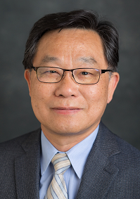 Shih-Lung Shaw, University of Tennessee Shih-Lung Shaw, University of Tennessee
Bio: Shih-Lung Shaw is Chancellor’s Professor and Alvin and Sally Beaman Professor of Geography at University of Tennessee, Knoxville (UTK). He received his Ph.D. and M.A. degrees from The Ohio State University and his B.S. degree from National Taiwan University. His research interests cover geographic information science, transportation geography, time geography, and spatiotemporal analysis of human dynamics. He served as the chair of UCGIS Research Committee (2017-2020), chair of the Transportation Geography Specialty Group (2000-2002), and secretary/treasurer of the GIS Specialty Group (1994-1996) of the American Association of Geographers (AAG), as well as Interim Associate Provost of International Education (2017-2018) and Head of the Geography Department (2007-2010) at UTK. He is a fellow of the American Association for Advancement of Science (AAAS), lead editor of Springer’s Human Dynamics in Smart Cities book series, and an editorial board member of several journals, including IJGIS and Journal of Transport Geography.
Statement: Thank you for this opportunity to be nominated for UCGIS President-Elect. I have been involved with UCGIS for many years, including serving as the Chair of UCGIS Research Committee in 2017-2020 that created several research working groups. UCGIS has played an important leadership role in support of GIScience research, education, and policy endeavors in higher education and with allied institutions over the past 26 years. As the GIScience field and the GIS community continue to evolve with the changing world, it is critical for UCGIS to consider new perspectives and ideas to continue its important service to the GIScience community. As the President-Elect, I hope to work with all of you to strengthen our national and international presence and engage the entire UCGIS community and beyond by establishing ad-hoc committees to explore new opportunities and identify current and future challenges of moving UCGIS forward.
Members, Board of Directors (two to be selected):
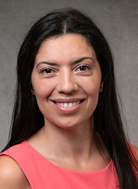 Patricia Carbajales-Dale, Clemson University Patricia Carbajales-Dale, Clemson University
Bio: Patricia Carbajales-Dale is the Executive Director of the Clemson Center for Geospatial Technologies, where she provides vision, leadership, and strategic direction of the Center’s programs and initiatives. Her team supports and trains over 2,000 students, staff, and faculty per year through academic and research initiatives, grant collaborations, management of cloud-computing and cyberGIS platforms, and collaborations with industry partners. Patricia also leads the Clemson Data Visualization Lab and is the Co-Director of the Sustainability in Pamplona Study Abroad Program. She currently serves in the Board of Directors of the American Association of Geographers (AAG) CyberInfrastructure Speciality Group, and in 2020 was selected by UCGIS to be a #TRELIS Fellow. Patricia has a passion for teaching GIS and Data Visualization, and has taught GIS for Public Health at Clemson since 2015. Previous to Clemson, Patricia established and ran the Stanford Geospatial Center for four years at Stanford University where she also held the position of GIS Lecturer within the School of Earth Sciences. She created and taught the first "GIS for Good" class, a service learning class where students from different disciplines partnered with the United Nations, and other international humanitarian organizations to create innovative solutions to real-world problems. She is currently a co-Investigator in several National Science Foundation (NSF) and National Institute of Justice (NIJ) grants.
Statement: I am honored to be nominated for election to the UCGIS Board of Directors. I remember fondly the first time I attended the UCGIS symposium as a student. I was inspired by the warm welcome and sense of camaraderie I received from leaders in the GIS field. I ardently believe UCGIS provides a unique opportunity for the GIScience community to connect, advance, and innovate. It is my hope that my non-traditional academic trajectory and experience with other organizations (ACI-REF – Advanced Cyberinfrastructure Research & Education Facilitation, Internet2, OpenGeoportal, CaRRC – Campus Research Computing Consortium) enables UCGIS to reach out to a wider range of communities. From my experience serving in the UCGIS education committee, I know first-hand the UCGIS board is open to new initiatives, where new members are encouraged to bring forward innovative ideas. My vision for UCGIS is to maintain the strong connection and fellowship at its core while expanding its membership and overall vision and collaborating with other organizations. I envision my role to be that of a catalyst or facilitator, where I can effectively integrate different points of view and initiatives to foster opportunities such that UCGIS continues to reflect the evolving landscape of GISsience.
 Kevin Curtin, University of Alabama Kevin Curtin, University of Alabama
Bio: Kevin M. Curtin received his PhD in Geography from the University of California – Santa Barbara, with a dual focus on GIS and optimal facilities location. He performs primary research in the field of Geographic Information Science with specializations in location science, transportation and logistics, spatial movement behavior, spatial statistics, and network GIS. Application areas for his research include autonomous vehicle logistics, transportation geography, crime studies, health and nutrition, and geospatial intelligence. He teaches extensively at both the undergraduate and graduate university levels, and has served on over 130 thesis and dissertation committees. Funding from the Office of Naval Research, the National Science Foundation, and the Army Research Institute is supporting students and faculty associated with his research group, the Laboratory for Location Science.
Statement: Since my first interaction with UCGIS as a newly minted academic, I have been struck by the similarity between my own interests and the mission of UCGIS. I am equally interested in both the research of GIScience and the education of the next generation of GIScientists. I am convinced that GIScience holds a unique place among disciplines, and that a strong advocate to champion those who practice it is a critical need. UCGIS fills that need, and goes above and beyond to organize members of the community of interest and articulate the desires of that community for the growth and progress of the discipline. I believe that my administrative experience in particular – as chair and associate dean – will be of particular advantage to the Board. That experience demanded a breadth of interaction with other disciplines, and therefore allowed me to become familiar with a wider range of methods for promoting and supporting an organization in furtherance of their common goals. I hope to use that experience to the benefit of UCGIS. It would be an honor to serve UCGIS and the wider academic and professional GIS community as a member of the Board of Directors.
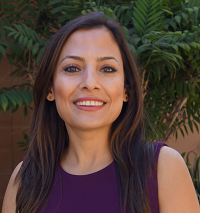 Somayeh Dodge, University of California, Santa Barbara Somayeh Dodge, University of California, Santa Barbara
Bio: I serve an assistant professor of Spatial Data Science and run the MOVE Research Lab at the Department of Geography at the University of California Santa Barbara (UCSB). My research focuses on the study of movement in human and ecological systems through developing human-centered and data-driven computational and visualization approaches to movement analytics, knowledge discovery, and modeling. I hold a PhD in Geography with a specialization in Geographic Information Science (GIScience), awarded by the University of Zurich, Switzerland in 2011. Prior to joining UCSB, I served as an assistant professor at the University of Minnesota (2016–2019) and at the University of Colorado Colorado Springs (2013–2016). My work has been supported by the National Science Foundation and is published in a number of high-ranked journals. I currently serve as the Co-Editor in Chief of the Journal of Spatial Information Science (JOSIS) as well as on the editorial boards of multiple journals including Geographical Analysis, Cartography and Geographic Information Science, Computer Environment and Urban Systems, Journal of Location Based Services, and The Professional Geographer.
Statement: Thanks for this opportunity! I am delighted and honored to be nominated for the election to the UCGIS Board of Directors. My involvement with the UCGIS started in 2016 when I served as the Knowledge Area Editor on the UCGIS Geographic Information Science and Technology Body of Knowledge 2.0. Later I received the honor to be selected as a 2018 TRELIS (Training and Retaining Leaders in STEM - Geospatial Sciences) fellow, and participated in the first UCGIS TRELIS workshop which was instrumental in my professional development. I currently serve as one of the UCGIS delegates on behalf of the UCSB. By serving on the UCGIS Board of Directors, I hope to achieve two main goals: (1) As the Co-Editor in Chief of JOSIS –the only open-access journal that is entirely run by academics and for the benefits of the GIScience community– I hope to advocate for open science and promote high-quality and free open access publishing in GIScience. (2) As an international scholar with a professional network that spans beyond the USA, I intend to strengthen the connections between the UCGIS and its European sister community AGILE (the Association of Geographic Information Laboratories in Europe), to advance research collaborations and build new opportunities for GIScience students through exchange programs and scholarships.
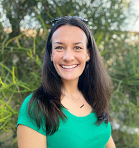 Amy Frazier, Arizona State University Amy Frazier, Arizona State University
Bio: Amy Frazier is an Assistant Professor in the School of Geographical Sciences and Urban Planning at Arizona State University and core faculty in the Spatial Analysis Research Center (SPARC) and Center for Global Discovery and Conservation Science. She holds degrees from the University at Buffalo (PhD, Geography, 2013), West Chester University (MA, Geography, 2008), and Dartmouth College (AB, Environmental Earth Science, 2002). She has been at ASU since 2018, and prior to that was on the faculty at Oklahoma State University, where she helped lead the effort for that institution to become a UCGIS member. She has been an ASU UCGIS delegate since 2019 and was in the inaugural fellow cohort of the TRELIS program (Training and Retaining Leaders in STEM – Geospatial Sciences). Frazier’s research lies at the intersection of GIScience, remote sensing, and landscape ecology, with specific focus on how issues of scale affect analyses. Her other leadership roles include serving on the Editorial Board for Landscape Ecology and the Diversity and Inclusion Committee for IALE.
Statement: I am thrilled to be considered for election to the UCGIS Board of Directors. I have been involved in UCGIS activities since the start of my academic career and believe wholeheartedly in the UCGIS mission. I helped lead the effort for my first institution to join UCGIS and more recently have served as a UCGIS delegate. UCGIS provides invaluable resources and support for community building and advancing GIScience across all career stages, and I am honored to have the opportunity to further this mission. If elected, I look forward to working with the rest of the leadership to expand and diversify our membership and continue to promote healthy growth of the organization. I also believe that the success of UCGIS resources and programming rests on reaching the right audiences, and I am eager to foster partnerships with external organizations across academic, government, public, and private entities to advance our networks to ensure the long-term success of UCGIS initiatives. Diversity, equity, and inclusion are integral to the success of any organization, and I am committed to creating, nurturing, and maintaining a diverse and inclusive UCGIS community where all voices are heard. I look forward to serving the UCGIS community in this role.
|

 David Bennett, University of Iowa
 Shih-Lung Shaw, University of Tennessee
 Patricia Carbajales-Dale, Clemson University
 Kevin Curtin, University of Alabama
 Somayeh Dodge, University of California, Santa Barbara
 Amy Frazier, Arizona State University