2023 UCGIS Elections
The Nominating Committee and the Board of Directors are honored to present these individuals to the UCGIS delegates for consideration in the 2023 elections. Online voting by delegates will begin 8am on Tuesday, May 23rd, 2023, and will conclude 8am on Tuesday, June 6th, 2023. Selected individuals will begin their positions on July 1, 2023.
President-Elect (one to be selected)
 Jeff Hamerlinck, University of Wyoming Jeff Hamerlinck, University of Wyoming
Bio: I am the Director and Senior Research Scientist with the Wyoming Geographic Information Science Center (www.uwyo.edu/wygisc) at the University of Wyoming, where I am also acting Co-Director of the School of Computing and a Faculty Fellow with the College of Business Daniels Fund Ethics Initiative. My PhD is in Geography from the University of Colorado-Boulder and I maintain credentials as both GIS Professional and member of the American Institute of Certified Planners. Over the last 25 years, I have served in a range of UCGIS capacities, from Council member to Board Secretary and Chair of the External Relations Committee. I’ve also served as the UCGIS representative on the GIS Certification Institute Board and the Council of Geospatial Organizations, and I am a former Knowledge Area Editor (“Domain Applications”) for the GIST Body of Knowledge. Through my state government engagement work, I participate in the National States Geographic Information Council, have consulted on interstate geospatial collaboration with the Western Governors’ Association, and am currently serving on the Wyoming Governor’s GIS Advisory Board.
Statement: I am honored to be nominated for President-Elect and enthusiastic about the opportunity to serve UCGIS in this important capacity. I’ve always been appreciative of how UCGIS has positively influenced my own career and amplified my home institution’s engagement with the higher education geographic information science community. UCGIS has demonstrated great resilience emerging from an unprecedented global pandemic - in the research contributions made by its members, in the new ways we’ve innovated our teaching, and in how we’ve fostered expanded and improved access across our professional network. I believe this response has made us stronger and reflects the ability of our community to adapt to an ever-evolving geospatial landscape across academia, government, and the commercial sector. Moving forward, I see great opportunity for an expanded vision for UCGIS, broadening our member base and our engagement with both existing professional affinity organizations (e.g., the Mapping Science Committee and the National Geospatial Advisory Committee) and new potential partners ranging from the Research Data Alliance to the UN initiative on Global Geospatial Information Management.
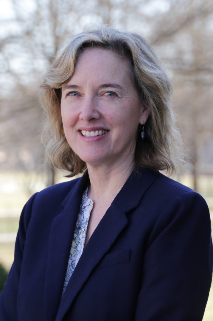 Kathleen Stewart, University of Maryland, College Park Kathleen Stewart, University of Maryland, College Park
Bio: Kathleen Stewart is Professor in the Department of Geographical Sciences and Director of the Center for Geospatial Information Science at the University of Maryland. Her research focuses on travel behaviors and mobility for both health and transportation domains. At the University of Maryland, Kathleen collaborates with researchers at the Center for Advanced Transportation Technology, the School of Public Health, and the University of Maryland School of Medicine among others. She serves as a member of the Geographical and Geospatial Science Committee of the National Academies of Sciences, Engineering and Medicine and as a member of the National Geospatial Advisory Committee. Kathleen has been involved in UCGIS activities for more than 20 years, and has served on the UCGIS Board of Directors (2016-2019) and as Chair (2010-2012) and Vice-Chair (2008-2010) of the Research Committee. She has also served on the UCGIS Nominating Committee, Research Award Committee, and Carolyn Merry Mentoring Award Committee on multiple occasions over the past years.
Statement: I am very honored to be nominated for the position of President-Elect with the UCGIS. My PhD is from the University of Maine, an institution, that has supported the UCGIS for many years and where I learned firsthand about the organization, and got my start as a grad student presenting at UCGIS summer symposia. Fast forward to 2023 where I am now Professor in Geographical Sciences and Director of the Center for Geospatial Information Science at the University of Maryland. As President-Elect, I would be interested in furthering the momentum coming out of the highly successful TRELIS program where a cadre of women geospatial scientists have been mentored and have formed career networks. I would like to work on what’s next for this effort, and in addition to increasing the opportunities for women, work on how we can also increase the number of individuals from underrepresented groups in the UCGIS and GIScience more broadly. This also ties into building a diverse pipeline of students at all levels in our geospatial educational programs. Additionally, through my participation on the National Geospatial Advisory Committee, I believe I can bring the latest in federal geospatial developments and efforts to the UCGIS, and build a pipeline between UCGIS participation and this important and interesting Federal Committee.
Members, Board of Directors (two to be selected):
 Jennifer N. Swift (she/her/hers), University of Southern California Jennifer N. Swift (she/her/hers), University of Southern California
Bio: Jennifer Swift teaches in the Population, Health and Place (post-graduate certificate and Ph.D. degree), Geographic Information Science and Technology Program (post-graduate certificate and M.S. degree), Spatial Data Science (M.S. degree), and the undergraduate GeoDesign Program (B.S. degree). The focus of Swift's research is in developing innovations in the use of 3D geospatial technologies in teaching, and in improving methods for teaching programming skills across Geographic Information Science as a discipline. Swift has supervised numerous MS theses and effectively pursued funding opportunities that support the development of innovations in teaching. Swift has guided graduate students and undergraduate students in research projects that have led to the publication of their work in peer-reviewed journals, successful participation in student research competitions, and presentations at national and international conferences. Swift serves as the Spatial Sciences Institute Diversity, Equity, and Inclusion (DEI) Task Force lead, seeking to ensure that students, staff, and faculty experience inclusiveness.
Statement: I sincerely wish to actively support UCGIS to the best of my abilities. Between 2018-2022, I served as the UCGIS Membership chair and continue to participate in and support this committee as an active member. In addition to the Membership Committee’s principal duties to increase and diversity membership, during this time frame the committee also revised and updated the UCGIS membership model, conducted a focus group of members to gather observations and provide recommendations to the UCGIS Board to enhance promotion of UCGIS and better support existing and future members, and effectively collaborated with the the UCGIS Communications Committee’s activities. As the world continues to evolve in technological innovations, UCGIS members’ research, teaching, and collaboration needs are also changing. I would be greatly honored to have the opportunity to support UCGIS in this growth, including support of all membership-related responsibilities deemed most critical by UCGIS members and leadership.
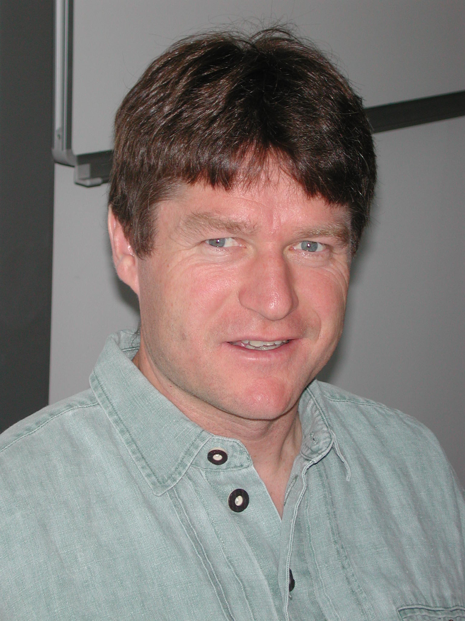 Michael Leitner, Louisiana State University Michael Leitner, Louisiana State University
Bio: Michael Leitner received a master degree at the Department of Geography and Regional Research, University of Vienna, Austria and a second master and a doctoral degree in Geographic Information Science (GISc) at the Department of Geography, State University of New York at Buffalo, US. He is the recipient of the 2007 Meredith F. Burrill Award from the Association of American Geographers, was appointed editor of Cartography and Geographic Information Science from 2008-14, and recipient of a Fulbright US Scholar Program Grant to the Jagiellonian University in Krakow, Poland from 2017-18. His main research interests are in Geographic Information Science and its application to spatial crime analysis, medical geography, cartography, and geospatial privacy. He has published six books, ten co-edited journal volumes, and 70+ refereed articles and book chapters. He has successfully received more than US$ 6 million in grant money in total to date.
Statement: I would be happy and am honored to serve the UCGIS community as a member of the Board of Directors. Educated as a (human) geographer and Geographic Information Scientist, my research and teaching interests have been inherently inter-/multidisciplinary and internationally. I have collaborated with researchers from the Social Sciences (Anthropology, Criminology, Sociology, and Psychology), the Medical-, Computer-, and Environmental Sciences, Statistics, Biology, and Engineering. I have taught classes and supervised graduate students from different cultural and ethnical backgrounds at different universities in the US and Europe (U. of Vienna, Salzburg, Klagenfurt, Graz, Carinthia U. of Applied Sciences (all Austria), U. of Tuebingen (Germany); and Jagiellonian U. and AGH U. of Science and Technology (Polen). For these reasons, I believe that I can contribute to the UCGIS with my expertise in inter-/multidisciplinary and international research. I am especially interested to attract universities outside of the US to join the UCGIS. I am also interested to attract new academic disciplines, departments, and universities to the UCGIS that are interested to expand their spatial turn in their research and teaching.
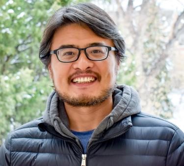 Guofeng Cao, University of Colorado Boulder Guofeng Cao, University of Colorado Boulder
Bio: Guofeng Cao is an assistant professor in the Department of Geography at University of Colorado Boulder. He obtained a Ph.D. in Geography and a M.A. in Applied Statistics from the University of California, Santa Barbara, and B.S. degree in Earth Sciences from Zhejiang University. He is interested in developing statistical and GeoAI methods to understand the complex spatiotemporal dynamics to support uncertainty-aware scientific discovery and practical decision making. His domain application areas focus on remote sensing, environmental health, climate changes and natural hazards. He has published over 50 peer-reviewed journal articles, 16 peer-reviewed conference proceedings and 6 book chapters. His research has been supported by NSF, USGS, NIST, NIH and USAID. He has served on the organizing or scientific committees of multiple international conferences (e.g., AGILE 2019, geoENV 2020) and served on the Election Committee of CPGIS (2020). He has been a UCGIS delegate of CU Boulder since 2021.
Statement: It is my honor to be nominated to join the UCGIS Board. UCGIS is the identity home of GIScience researchers and educators in the US. Since the inception in 1995, the organization has been playing a critical role for advancing and promoting GIScience. I am thrilled to have the opportunity to contribute to our home organization. If elected, I will work with the leadership team to further advance the UCGIS mission and excellence, and to help address the challenges that the organization is facing. Working with the network of researchers from diverse background and disciplines, I will promote deep transdisciplinary collaboration to address the emerging challenges and opportunities in GIScience, e.g., the impact of AI in GIScience research and education. I will support the UCGIS outreaching activities to promote the successful stories of GIScience to public. I also plan to leverage the collaboration network to broaden our member base and to promote the engagement of UCGIS with under-represented disciplines, institutes or industrial sectors in the communities of GIScience.
 Eric Shook, University of Minnesota Eric Shook, University of Minnesota
Bio: Eric Shook is an Associate Professor at the University of Minnesota in the Twin Cities, specializing in geospatial computing. He is the Co-Director of the Master of GIScience program and is leading the development of the GeoCommons, a hub for geospatial research, teaching, and public engagement. Dr. Shook has served as Vice-Chair of the UCGIS Education Committee (2017-current), UCGIS Delegate for Kent State University (2013-2016), Section Editor for "Computing Platforms" Knowledge Area in the UCGIS GIS&T Body of Knowledge (2016–2019), Chair for the AAG Cyberinfrastructure Specialty Group (CISG, 2014-2015), and Domain Champion for GIS for the Extreme Science and Engineering Discovery Environment (XSEDE, 2016-2022). Dr. Shook is also the PI of the NSF-funded Hour of Cyberinfrastructure project that aims to build cyber literacy for GIScience among undergraduate and graduate students and co-leads the Education and Workforce Development Group for I-GUIDE, an NSF-supported institute for geospatial understanding.
Statement: I am honored to be nominated to serve as a member of the UCGIS Board of Directors. As a dedicated member of the UCGIS community, I am passionate about advancing both the research and education missions of UCGIS, while also actively contributing to reshaping our collective identity and vision as the field of GIScience continues to evolve. I believe our success depends on building a supportive community that values and respects all individuals. I am committed to collaborating with my colleagues toward these objectives and creating an environment that fosters innovation, promotes diversity and inclusivity, and elevates the field's profile.
|