Speakers and Presenters
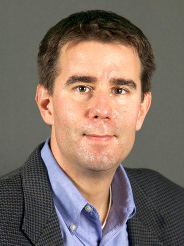
Brett Bobley, Director & Chief Information Officer, National Endowment for the Humanities

Brett Bobley is the Chief Information Officer for the National Endowment for the Humanities. He also serves as the Director of the Office of Digital Humanities. Brett has a B.A. in philosophy from the University of Chicago and an M.S. in computer science from the Johns Hopkins University. In 2006 Brett received a Chief Information Officers (CIO) Council Leadership Award from the Office of Management and Budget. In 2007 he received a Presidential Rank Award from the President of the United States in recognition of his exceptional long-term accomplishments, such as cofounding the federal government’s Small Agency CIO Council and establishing the NEH Office of Digital Humanities.
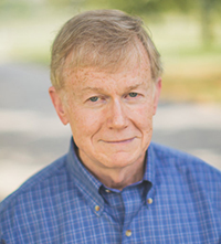
David Bodenhamer, The Polis Center and Indiana University - Purdue University Indiana (IUPUI)
 David Bodenhamer is (founding) Executive Director of The Polis Center and Professor of History at IUPUI. Prior to his appointment, he was Professor of History and Associate Vice President for Academic Affairs at the University of Southern Mississippi (1976-1988). David Bodenhamer is (founding) Executive Director of The Polis Center and Professor of History at IUPUI. Prior to his appointment, he was Professor of History and Associate Vice President for Academic Affairs at the University of Southern Mississippi (1976-1988).
Bodenhamer’s work in the new field of spatial humanities includes The Spatial Humanities: GIS and the Future of Humanities Scholarship (Indiana University Press, 2010) and Deep Maps and Spatial Narratives (Indiana University Press, 2015), in addition to a dozen published essays. Both books were developed with Professors John Corrigan (religious studies) and Trevor Harris (geography), collaborators in the interdisciplinary Virtual Center for Spatial Humanities (VCSH), an institutional partnership among Florida State University, West Virginia University, and IUPUI.
Bodenhamer serves as co-director of the VCSH, which he created with Corrigan and Harris in 2008 to advance the field of spatial humanities. He also serves as co-general editor of the Indiana University Press Series on Spatial Humanities and co-editor of the IJHAC: A Journal of the Digital Humanities (formerly the International Journal of Humanities and Arts Computing, Edinburgh University Press).
Tuesday Panel: Integrating Space and Place in GIScience: Examples, Challenges and Opportunities
|
|
 Clio Andris is an assistant professor of geography at Penn State University and director of the Friendly Cities Lab. At Penn State, she is an associate of the Institute for CyberScience, a faculty member in the Social Data Analytics program, and an affiliate of the Population Research Institute. Her research is on social networks, social flows and representing personal relationships in GIS. She was formerly a postdoc at the Santa Fe Institute and the Singapore-MIT Alliance for Research and Technology. She holds a PhD in Urban Information Systems from MIT where she was a National Defense Science and Engineering Graduate Fellow. Clio Andris is an assistant professor of geography at Penn State University and director of the Friendly Cities Lab. At Penn State, she is an associate of the Institute for CyberScience, a faculty member in the Social Data Analytics program, and an affiliate of the Population Research Institute. Her research is on social networks, social flows and representing personal relationships in GIS. She was formerly a postdoc at the Santa Fe Institute and the Singapore-MIT Alliance for Research and Technology. She holds a PhD in Urban Information Systems from MIT where she was a National Defense Science and Engineering Graduate Fellow.
|
|
 Karl Grossner is Technical Director of the NEH-funded World-Historical Gazetteer project based at the University of Pittsburgh’s World History Center, a linked open data system with global scope. Karl has a PhD in Geography from the University of California, Santa Barbara (2010). His basic research in GIScience has focused on several aspects of “computing place” for historical research, including semantic modeling, representations of temporality, and the uncertainty inherent in historical data. Throughout his academic career, Karl has sought to bring encourage dialog and collaboration between GIScientists and humanities scholars. In 2014, he and Katherine Hart co-founded the GeoHumanities SIG of the Alliance for Digital Humanities Organizations (ADHO) towards that aim. Karl Grossner is Technical Director of the NEH-funded World-Historical Gazetteer project based at the University of Pittsburgh’s World History Center, a linked open data system with global scope. Karl has a PhD in Geography from the University of California, Santa Barbara (2010). His basic research in GIScience has focused on several aspects of “computing place” for historical research, including semantic modeling, representations of temporality, and the uncertainty inherent in historical data. Throughout his academic career, Karl has sought to bring encourage dialog and collaboration between GIScientists and humanities scholars. In 2014, he and Katherine Hart co-founded the GeoHumanities SIG of the Alliance for Digital Humanities Organizations (ADHO) towards that aim.
|
|
 Yingjie Hu is an Assistant Professor in the Department of Geography at the University at Buffalo (UB) and the National Center for Geographic Information and Analysis (NCGIA). His major research area is in geographic information science (GIScience), and more specifically in spatial, temporal, and textual data analytics, geospatial semantics, and geographic information retrieval. He develops and integrates spatial analysis methods, natural language processing, machine learning and deep learning techniques to discover a variety of knowledge from data for supporting disaster response, urban planning, and other applications. He received his PhD from the University of California Santa Barbara. Yingjie Hu is an Assistant Professor in the Department of Geography at the University at Buffalo (UB) and the National Center for Geographic Information and Analysis (NCGIA). His major research area is in geographic information science (GIScience), and more specifically in spatial, temporal, and textual data analytics, geospatial semantics, and geographic information retrieval. He develops and integrates spatial analysis methods, natural language processing, machine learning and deep learning techniques to discover a variety of knowledge from data for supporting disaster response, urban planning, and other applications. He received his PhD from the University of California Santa Barbara.
|
 Jim Thatcher is Assistant Professor of Urban Studies at the University of Washington Tacoma and an affiliate with the graduate school of Geography at the University of Washington. Often referred to as Critical Data Studies or Digital Political ecologies, his work examines the recursive relations among extremely large geospatial data sets, the creation and analysis of those datasets, and society, with a focus on how data has come to create, shape, and sustain modern urban environments. He is the lead editor of a 2018 University of Nebraska Press book on the roles ‘big data’ has come to play within and across academic Geography and his second book, on resistance to the power of data in our daily lives, is under contract with Pluto Press. Jim Thatcher is Assistant Professor of Urban Studies at the University of Washington Tacoma and an affiliate with the graduate school of Geography at the University of Washington. Often referred to as Critical Data Studies or Digital Political ecologies, his work examines the recursive relations among extremely large geospatial data sets, the creation and analysis of those datasets, and society, with a focus on how data has come to create, shape, and sustain modern urban environments. He is the lead editor of a 2018 University of Nebraska Press book on the roles ‘big data’ has come to play within and across academic Geography and his second book, on resistance to the power of data in our daily lives, is under contract with Pluto Press. |
| Tuesday Paper Session, Track #1 |
|
Tuesday Paper Session, Track #2 |
| Shih-Lung Shaw, University of Tennessee, and Daniel Sui, University of Arkansas |
A Space-Place GIScience Framework for Transdisciplinary Geospatial Humanities |
|
Chris Marder, University of Southern California |
The Role of Precision in Spatial Narratives: Using a Modified Discourse Quality Index to Measure the Quality of Deliberative Spatial Data |
| Luke Bergmann, University of British Columbia |
Speculative GIScience: for geographical imagination systems (gis) |
|
Daniel Griffith, University of Texas at Dallas |
A spatial analysis of selected art: a GIScience-humanities interface |
| Tiffany Earley-Spadoni, University of Central Florida |
Spatial Archaeology: Mapping the Ancient Past with Sciences and the Humanities |
|
Carolynne Hultquist, Penn State University |
Representation in Geosocial Data: Grappling with Uncertainty in Digital Traces of Human Activity |
| Stephen Appel, University of Wisconsin at Milwaukee |
Letters from Spain in a space/time box: understanding the chronotopes of 19th-century travel and travelogues through historical GIS and 3D visualization |
|
Harlan Onsrud, University of Maine |
Being Human Under Pervasive Tracking and Algorithmic Controls |
| Don Lafreniere, Michigan Tech University |
HGIS 2.0 - Historical spatial data infrastructures: a trans-disciplinary approach to deep mapping industrial heritage |
|
Bo Zhao, Oregon State University |
Humanistic GIS: An Individual's Pursuit of Poetic Dwelling on Digital Earth |
| Piet Gerrits and M.Erdem Kabadayi, Koc University, Istanbul, Turkey |
Bridging the gap between pre-census and census era historical data: Devising a geo-sampling model to analyze agricultural production in the long-run for Southeast Europe and Anatolia, 1840-1940 |
|
|
|
Wednesday Panel: Building a Bridge to the Humanities with GIScience
|
|
 Edward Ayers has worked in the digital humanities since the inception of the field. For the last decade he has worked with the Digital Scholarship Lab at the University of Richmond as co-editor of American Panorama: A Digital Atlas of United States History. He has been named National Professor of the Year, received the National Humanities Medal at the White House, served as president of the Organization of American Historians, and won the Bancroft Prize in American history. Ayers is one of the cohosts for BackStory, a popular podcast about American history. His newest book, The Thin Light of Freedom: The Civil War and Emancipation in the Heart of America, received the Lincoln Prize. He is Tucker-Boatwright Professor of the Humanities and president emeritus at the University of Richmond. Edward Ayers has worked in the digital humanities since the inception of the field. For the last decade he has worked with the Digital Scholarship Lab at the University of Richmond as co-editor of American Panorama: A Digital Atlas of United States History. He has been named National Professor of the Year, received the National Humanities Medal at the White House, served as president of the Organization of American Historians, and won the Bancroft Prize in American history. Ayers is one of the cohosts for BackStory, a popular podcast about American history. His newest book, The Thin Light of Freedom: The Civil War and Emancipation in the Heart of America, received the Lincoln Prize. He is Tucker-Boatwright Professor of the Humanities and president emeritus at the University of Richmond.
|

Katherine Hart is the Head of the Geography and Map Division's Reading Room at the Library of Congress. She obtained her MLIS from Louisiana State University and has spent her career focused primarily on access to and use of maps and geographic information in academic libraries. She is past Chair of the American Library Association's Map and Geographic Information Round Table and received that group's Honors Award. She co-edited the Journal of Map and Geography Libraries. Along with Karl Grossner, Kathy co-founded the GeoHumanities SIG within the Alliance of Digital Humanities Organizations, a group which fosters communication and collaboration among humanists working with geographic information.
|

Robert T. Tally Jr. is the NEH Distinguished Teaching Professor in the Humanities and Professor of English at Texas State University. His books include Topophrenia: Place, Narrative, and the Spatial Imagination (2019), Fredric Jameson: The Project of Dialectic Criticism (2014), Spatiality (2013), Utopia in the Age of Globalization (2013), and, as editor, Teaching Space, Place, and Literature (2018), The Routledge Handbook of Literature and Space (2017), Literary Cartographies (2014), and Geocritical Explorations (2011). The translator of Bertrand Westphal’s Geocriticism (2011), Tally is also the general editor of “Geocriticism and Spatial Literary Studies,” a Palgrave Macmillan book series.
|
| Poster Presentations, Tuesday, June 11, 2019 |
| Daniela Agostini, North Carolina State University |
Interactive, online tools to understand research trends and identify opportunities for research in the U.S. National Parks system |
| John Glover, University of Redlands |
Moving Frontiers of Historical Climate Change and Violence in West Africa |
| Chryse Kruse, Anne Cavender, and Alana Belcon, all at the University of Redlands |
A Spatial Approach to William Carlos Williams |
| Lillian Larsen, University of Redlands |
Redrawing the Map of Religion |
| Sharon Oster, University of Redlands |
Cartographies of Suffering: Mapping Holocaust Testimonies |
| Chayanika Singh, Texas State University |
Accessibility and Activity : Can Twitter detect the association. A Spatial Analysis perspective on physical activity |
| Karl Grossner, University of Pittsburgh |
World-Historical Gazetteer |
| Wednesday Paper Session, Track #1 |
|
Wednesday Paper Session, Track #2 (Lightning Talks) |
| Juliette Morel, Université de Limoges, France |
Construction and Management of a Geo-Historical Information System for an Interdisciplinary and Contributory Regional and Historical Atlas: The Historical Atlas of Limousin’s example |
|
Paulo Raposo and Mark Colen, University of Tennessee |
Morphological Measurements Compared to Human Landscape Preference |
| Charles Travis, University of Texas, Arlington |
Deep American Wests, 1840-2017: Literature, Sense of Place and Rootlessness Beyond the 98th Meridian |
|
Safitri Widagdo, Johns Hopkins University |
Shared Places - Exploring an Ontology and Graph Dataset for Literary Geography |
| Nung-yao Lin, Max Planck Institute for the History of Science |
Displaying spatial epistemologies on web GIS: using visual materials from the Chinese local gazetteers as an example |
|
Shaun Williams, Louisiana State University & Fort Polk |
Mapping Legacies of Former African-American High Schools in 1870-1960s Louisiana |
| |
|
|
Melinda Kernik, University of Minnesota |
Teaching the next generation of spatial humanists through story maps |
| |
|
|
Robert Roth, University of Wisconsin |
Map-based Storytelling for the Geohumanities |
|
 David Bodenhamer is (founding) Executive Director of The Polis Center and Professor of History at IUPUI. Prior to his appointment, he was Professor of History and Associate Vice President for Academic Affairs at the University of Southern Mississippi (1976-1988).


 Clio Andris is an assistant professor of geography at Penn State University and director of the Friendly Cities Lab. At Penn State, she is an associate of the Institute for CyberScience, a faculty member in the Social Data Analytics program, and an affiliate of the Population Research Institute. Her research is on social networks, social flows and representing personal relationships in GIS. She was formerly a postdoc at the Santa Fe Institute and the Singapore-MIT Alliance for Research and Technology. She holds a PhD in Urban Information Systems from MIT where she was a National Defense Science and Engineering Graduate Fellow.
 Karl Grossner is Technical Director of the NEH-funded World-Historical Gazetteer project based at the University of Pittsburgh’s World History Center, a linked open data system with global scope. Karl has a PhD in Geography from the University of California, Santa Barbara (2010). His basic research in GIScience has focused on several aspects of “computing place” for historical research, including semantic modeling, representations of temporality, and the uncertainty inherent in historical data. Throughout his academic career, Karl has sought to bring encourage dialog and collaboration between GIScientists and humanities scholars. In 2014, he and Katherine Hart co-founded the GeoHumanities SIG of the Alliance for Digital Humanities Organizations (ADHO) towards that aim.
 Yingjie Hu is an Assistant Professor in the Department of Geography at the University at Buffalo (UB) and the National Center for Geographic Information and Analysis (NCGIA). His major research area is in geographic information science (GIScience), and more specifically in spatial, temporal, and textual data analytics, geospatial semantics, and geographic information retrieval. He develops and integrates spatial analysis methods, natural language processing, machine learning and deep learning techniques to discover a variety of knowledge from data for supporting disaster response, urban planning, and other applications. He received his PhD from the University of California Santa Barbara.
 Edward Ayers has worked in the digital humanities since the inception of the field. For the last decade he has worked with the Digital Scholarship Lab at the University of Richmond as co-editor of American Panorama: A Digital Atlas of United States History. He has been named National Professor of the Year, received the National Humanities Medal at the White House, served as president of the Organization of American Historians, and won the Bancroft Prize in American history. Ayers is one of the cohosts for BackStory, a popular podcast about American history. His newest book, The Thin Light of Freedom: The Civil War and Emancipation in the Heart of America, received the Lincoln Prize. He is Tucker-Boatwright Professor of the Humanities and president emeritus at the University of Richmond.
